Page Title
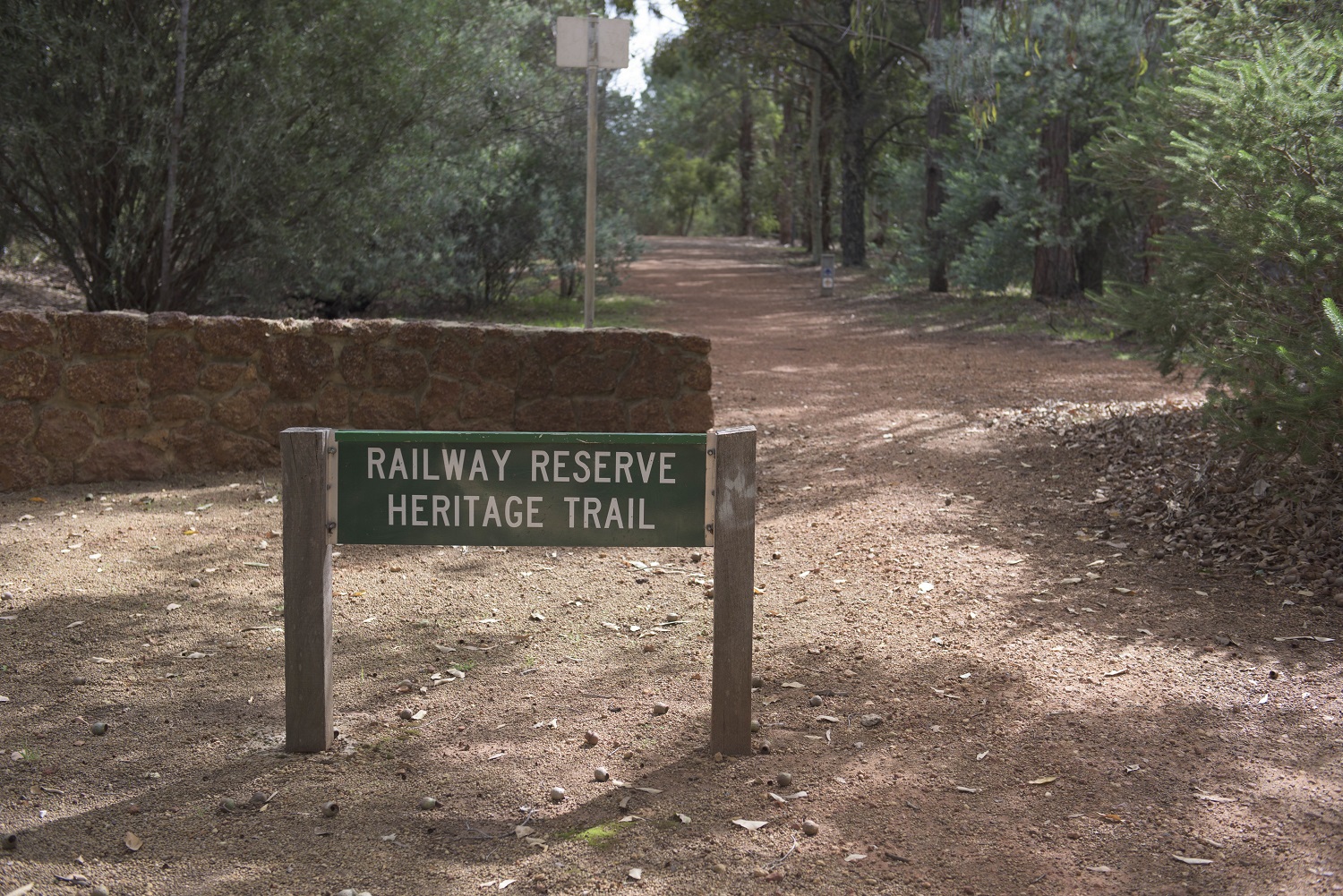
Railway Reserves Heritage Trail retraces 59km of the old Eastern Railway, passing through reserves you will discover the individual history, story and character of the settlements that sprung up alongside the line.
The most Western point to start your journey is from Bellevue where you can follow the old Eastern Railway lines either in a north or south direction of Great Eastern Highway. The two lines rejoin at Mount Helena forming a unique 41km loop entirely on railway formations before extending 18km east to Wooroloo Reserve.
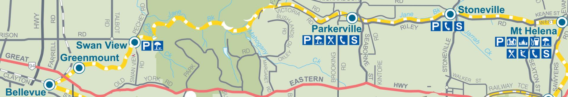
Access to Railway Reserves Heritage Trail is free, although a National Park fee applies for visitors who access the Trail from John Forrest National Park's main car park. It is suitable for walking and cycling, with dogs welcome on a lead and horses can be ridden along the Trail, except in National Parks.
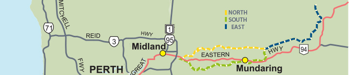
North
The North section of the Railway Reserves Heritage Trail is 19.1km from Bellevue to Mt Helena and further details on each section can be found below.
Bellevue to Greenmount 1.1 km
Greenmount to Swan View 2.5 km
Swan View to Parkerville 8.4 km
Parkerville to Stoneville 3.4 km
Stoneville to Mt Helena 3.7 km
South
The South section of the Railway Reserves Heritage Trail is 21.6 km from Bellevue to Mt Helena.
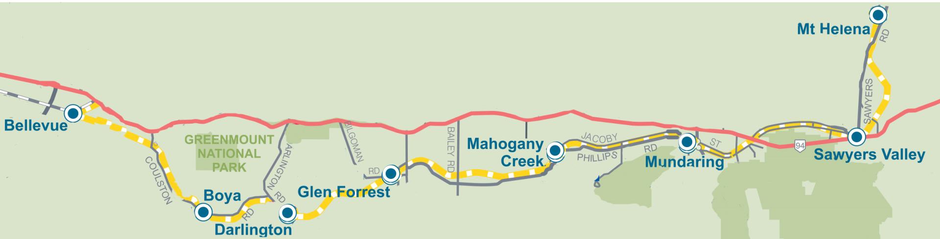
Bellevue to Boya 3.6km
Boya to Darlington 2.1km
Darlington to Glen Forrest 2.5km
Glen Forrest to Mahogany Creek 3.8km
Mahogany Creek to Mundaring 2.9km
Mundaring to Sawyers Valley 3.8km
Sawyers Valley to Mt Helena 2.9km
East
The East section of the Railway Reserves Heritage Trail is 18km km from Mt Helena to Wooroloo and further details on each section can be found below.
Mt Helena to Chidlow 6 km
Chidlow to Wooroloo 12 km
History
The Eastern Railway made the forest areas accessible which created employment, townships, transport, people movement, communication and mail transportation in the Shire of Mundaring. Locally this significance was highlighted between 1880 and 1930 when the Eastern Railway replaced the York Road as the area's principal lifeline.
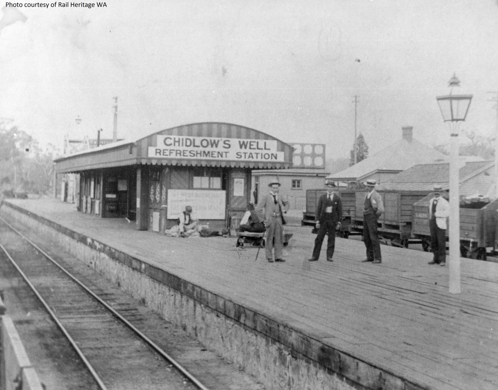
The first section of the railway line was constructed from Fremantle to Guildford and opened in 1881, the second section from Guildford to Chidlow's Well opened in 1884 and the final section from Chidlow's Well to York was opened in 1885. The railway construction and improved transport options for timber milling created an expansion of saw milling operations, which led to various railway problems.
An accident at Cape Horn near Boya highlighted the difficulties with the railway's sharp curves and steep gradients in addition to the difficulty finding reliable clean water to service the trains. In 1893 the misnamed Mahogany Creek Deviation was commissioned from Bellevue to Lion Mill (Mt Helena) via a tunnel to be built through rock at Swan View and officially opened in 1896. Clean reliable water was solved from building a reservoir near Chidlow's Well, now known as Lake Leschenaultia.
Although the railway line closed in 1966 there are three categories of railway structures that remain. The most significant legacy remaining is the gradient bridle and walk trails that follow the original lines and are landmarked by a series of information shelters.
Engineering structures remain as a monument of incredible feats of engineering and manual labour. They include the construction of the Swan View Tunnel, three trestle bridges that remain in the John Forrest National Park and the arched stone culvert in Wooroloo.
The third category of structures that remain are just off the actual lines, the former railway houses of Glen Forrest, Mundaring and Wooroloo station masters and the settlements which arose as service centres for the railway era, remain today as vibrant local communities.
Photos of old trains along the Swan View line can be found here.
Getting Here
The Shire of Mundaring is located 18km east of Perth along Gt Eastern Hwy (National Highway 94), about a 30-minute drive.
By Car
Car parking is available adjacent to the Trail in most townsites as indicated on the Railway Reserves Heritage Trail brochure map. There are multiple entry and exit points for the Trail, with most townsites having parking facilities nearby.
By Bus
If you are using public transport, Eastern Timetables 86, 96 and 97 provide bus routes to most townsites along the Trail. Visit Transperth or call 13 62 13 for more information.
By Bike
The Trail also connects with Perth Bicycle Network routes SE3 and SE4 and is accessible from Perth Airport.
Further publications can be found at:
Perth to Midland Bike Route Maps
Department of Transport Cycling Publications
Transperth Bus Timetables
Other Trails
John Forrest National Park
Park Road, Hovea 24km E of Perth
John Forrest National Park is WA's oldest national park and offers bushwalking, Mountain bike riding, picnicking, wildlife observation and photography opportunities of the park and the National Park falls. Walk trails very from an easy 2km to a more challenging 15km trail.
Kep Track
Mundaring – Northam (75km)
The Kep Track uses the rail formation between Mundaring, to Northam, east of Perth. The trail can take anywhere from a one to two hour walk, a bush outing for you and your horse, or a cycle adventure of several days.
Munda Biddi
Mundaring to Albany (1000km)
The Munda Biddi Trail is a nature-based, off-road cycling experience, where a unique trail has been built through an undeveloped natural corridor from Mundaring to Albany.
Lake Leschenaultia
Chidlow – Rosedale Rd
Walk or cycle 3km around the Lake perimeter to view a range of nature trees like marri and wandoo, together with an abundance of bird life including ducks, geese, herons and swamp hens.
There is also a 5.2km mountain bike circuit within the reserve. This trail gently winds through the forest to the north of the lake and is particularly attractive during the wildflower season.
Contacts
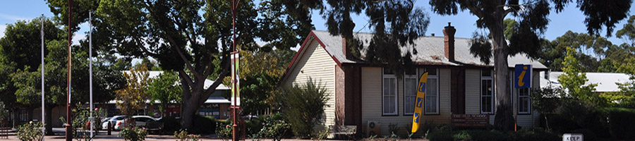
Perth Hills Mundaring Visitor Centre is conveniently situated in the centre of Mundaring, sharing the Old School House with the district museum. Ample parking is available.
A great range of Perth Hills maps and brochures on local walk and cycle trails are available and they sell Munda Biddi Trail and Bibbulmun Track maps, as well as a range of local products, gifts, cards and postcards.
Friendly staff and volunteers have a wealth of local knowledge and look forward to welcoming you.
Please note: The centre is closed Christmas Day, Boxing Day, New Year’s Day and Good Friday.
|
Contact
|
|
Opening Hours
|
Monday:
|
9.30am to 4pm
|
|
Tuesday:
|
9.30am to 4pm
|
|
Wednesday:
|
9.30am to 4pm
|
|
Thursday:
|
9.30am to 4pm
|
|
Friday:
|
9.30am to 4pm
|
|
Saturday:
|
9.30am to 4pm
|
|
Sunday:
|
10am to 2.30pm
|
|